Here is a number that should keep you up at night: by 2050, the world will need to produce roughly 60 percent more food than it does today to feed a projected population of nearly 10 billion people. And it will need to do this with less water, less arable land, and a climate that is becoming more unpredictable by the year. That is not a challenge you solve by simply planting more crops and hoping for the best. It is a challenge that demands precision -- knowing exactly what every patch of soil needs, exactly when it needs it, and exactly how much to provide.
That kind of precision, it turns out, requires looking at farms from space.
Satellite technology and GPS have quietly revolutionized agriculture over the past two decades. Today, farmers in Iowa and Uttar Pradesh alike use satellite imagery to assess crop health, GPS-guided tractors to plant seeds with centimeter accuracy, and space-based soil moisture data to decide when and how much to irrigate. The results are striking: studies have shown yield improvements of 15 to 20 percent in operations that adopt precision agriculture techniques, along with significant reductions in water use, fertilizer waste, and environmental impact.
This is the story of how space technology is helping feed the world -- and why it matters more than ever.
Seeing Crops from Above: NDVI and Satellite Imagery
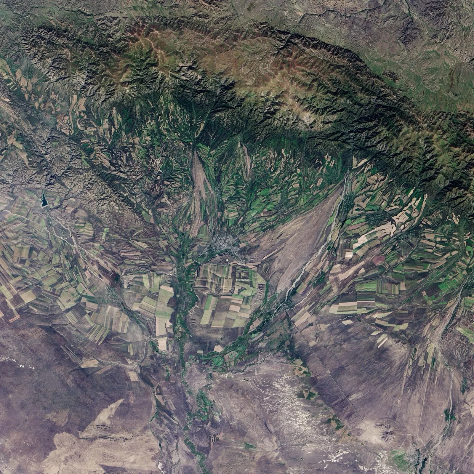
The foundation of satellite-based agriculture is a deceptively simple measurement called the Normalized Difference Vegetation Index, or NDVI. Here is how it works: healthy plants absorb most visible light (especially red) for photosynthesis but strongly reflect near-infrared light. Stressed, diseased, or malnourished plants reflect more visible light and less near-infrared. By comparing the ratio of these two wavelengths in satellite imagery, you get a single number -- the NDVI score -- that tells you how healthy the vegetation is.
An NDVI map of a farm field reveals information that would be invisible to a farmer walking through the rows. It shows which zones are thriving and which are struggling. It reveals patterns caused by drainage problems, nutrient deficiencies, pest infestations, or soil compaction. And it does this across the entire field at once, repeatedly, throughout the growing season.
The European Sentinel-2 satellites capture multispectral imagery at 10-meter resolution every five days, providing farmers with frequent, free updates on crop condition. Commercial satellite operators like Planet Labs offer daily imagery at even higher resolution. Combined with cloud platforms that process the data automatically, this means a farmer can check the health of every field on a smartphone, spot problems days or weeks before they become visible to the naked eye, and target interventions precisely where they are needed.
This targeted approach is the core of precision agriculture. Instead of applying the same amount of fertilizer uniformly across a field, a farmer can create variable-rate application maps based on NDVI data, putting more nutrients where plants are struggling and less where they are already healthy. The savings in fertilizer alone can be substantial -- and since excess nitrogen fertilizer is a major source of water pollution and greenhouse gas emissions, the environmental benefits compound the economic ones.
Soil Moisture from Space: NASA's SMAP Mission
Water is the most critical input in agriculture, and knowing how much moisture is in the soil is essential for irrigation management. Too little water stresses crops and reduces yields. Too much wastes a precious resource and can cause root diseases and nutrient leaching.
NASA's SMAP (Soil Moisture Active Passive) satellite, launched in 2015, measures soil moisture in the top five centimeters of soil across the entire globe every two to three days. It does this using a radiometer that detects naturally emitted microwave radiation from the soil surface. Wet soil emits microwaves differently than dry soil, allowing SMAP to map moisture content with remarkable accuracy.
SMAP data is integrated into agricultural decision support systems worldwide. Farmers and agricultural advisors use it to optimize irrigation scheduling, predict drought stress before it damages crops, and plan planting dates based on soil readiness. In regions where water scarcity is a constant challenge -- parts of India, sub-Saharan Africa, the American West, and Australia -- SMAP data helps ensure that every drop of irrigation water is used as efficiently as possible.
The ESA's Soil Moisture and Ocean Salinity (SMOS) mission provides complementary data, and upcoming missions promise even higher resolution soil moisture measurements. As this data becomes more accessible and easier to integrate with farm management software, its impact on water conservation in agriculture will only grow.
Weather Forecasting: The Space-Based Backbone
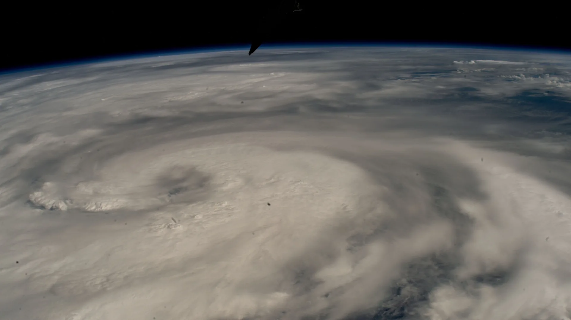
Every farmer is an amateur meteorologist by necessity. Planting, spraying, irrigating, and harvesting decisions all depend on weather conditions. Modern weather forecasting would be impossible without the constellation of meteorological satellites that ring the globe.
Geostationary satellites like GOES (US), Meteosat (Europe), and Himawari (Japan) provide continuous monitoring of weather patterns from fixed positions 36,000 kilometers above the equator. Polar-orbiting satellites like NOAA-20 and MetOp provide detailed atmospheric profiles used in numerical weather prediction models. Together, they enable the five-to-seven-day forecasts that farmers rely on daily.
For agriculture, the improvement in weather forecasting accuracy over the past few decades has been enormous. A five-day forecast today is as accurate as a one-day forecast was in the 1980s, and this improvement is largely attributable to satellite data. Better forecasts mean better decisions: when to spray (avoiding rain that would wash away pesticides), when to harvest (catching a dry window), and when to irrigate (anticipating upcoming rainfall that might make irrigation unnecessary).
Seasonal and subseasonal forecasts, which are improving thanks to better satellite observations of sea surface temperatures and soil moisture, help farmers make longer-term decisions about what crops to plant and when. In drought-prone regions, early warning systems driven by satellite data give farmers months of lead time to adjust their strategies.
GPS-Guided Farming: Centimeter Precision at Field Scale
If satellite imagery is the eyes of precision agriculture, GPS is its hands. GPS-guided tractors, planters, and sprayers can follow pre-programmed paths across fields with centimeter-level accuracy using Real-Time Kinematic (RTK) GPS corrections.
This precision has transformative effects. Rows can be planted perfectly straight and evenly spaced, eliminating the overlap and gaps that waste seed and reduce yields. Controlled traffic farming -- where all machinery follows the same GPS-guided tracks -- confines soil compaction to permanent tramlines, leaving the rest of the field loose and healthy. Auto-steer systems allow farmers to work in low visibility conditions, at night, and during long shifts without loss of accuracy.
GPS guidance also enables variable-rate technology. Using prescription maps derived from satellite imagery, soil sampling, and yield data, GPS-guided equipment can automatically adjust seeding rates, fertilizer application, and pesticide spraying on the fly as it moves through the field. One zone might get 10 percent more nitrogen, another 15 percent less, all managed automatically based on data rather than guesswork.
The cost savings are real. Studies consistently show that GPS guidance reduces input overlap by 5 to 10 percent, which alone can save thousands of dollars per season on a large farm. Combined with variable-rate application, total input cost reductions of 10 to 20 percent are commonly reported.
Drones Meet Satellites: Data Fusion for Maximum Insight
While satellites provide wide-area coverage, agricultural drones offer ultra-high-resolution imagery of individual fields. The emerging best practice is to fuse satellite and drone data: satellites identify problem areas across the farm, then drones are deployed for close-up investigation.
A satellite NDVI map might reveal a patch of low vigor in a wheat field. A drone flyover of that specific area, carrying a multispectral camera, can resolve individual plant rows and identify whether the problem is a nutrient deficiency, waterlogging, pest damage, or disease. The farmer can then treat only the affected zone, rather than applying a blanket treatment to the entire field.
This data fusion approach is particularly powerful when combined with ground-based sensors and soil sampling. Satellite data provides the big picture, drone data provides the detail, and ground measurements provide the calibration. Together, they create a comprehensive picture of field conditions that was simply impossible a generation ago.
Real-World Impact: India, Europe, and Beyond
The impact of space technology on agriculture is not theoretical -- it is being measured in fields around the world.
In India, ISRO has been a pioneer in applying space technology to agriculture. The Mahalanobis National Crop Forecast Centre uses satellite data to predict crop production across India's vast and diverse agricultural landscape. ISRO's Bhuvan platform provides farmers with satellite-derived advisories on crop condition, soil moisture, and weather. Village-level crop maps created from satellite imagery help agricultural extension officers target their guidance. In states like Andhra Pradesh and Maharashtra, pilot programs using satellite-based crop insurance have reduced fraud and improved payouts to farmers after crop failures.
In Europe, the Copernicus agricultural services provide free, continent-wide monitoring of crop conditions, drought indicators, and land surface temperatures. The data feeds into the European Commission's MARS (Monitoring Agricultural Resources) system, which produces crop yield forecasts used for food security planning across the EU. Individual farmers access Copernicus data through commercial platforms that translate raw satellite imagery into actionable field-level advice.
Research trials across multiple countries and crops have demonstrated the tangible benefits. A meta-analysis of precision agriculture studies found average yield increases of 15 to 20 percent for operations that adopted satellite-guided variable-rate fertilization, with some studies reporting even larger gains in fields with high spatial variability. Water savings of 20 to 30 percent have been documented in precision irrigation systems guided by satellite soil moisture data.
The Democratization of Precision Agriculture
Perhaps the most exciting trend is the falling cost of access. A decade ago, precision agriculture was primarily the domain of large, well-capitalized farms in developed countries. High-resolution satellite imagery was expensive, GPS equipment carried hefty price tags, and the software to process and apply the data was complex and costly.
Today, the economics have shifted dramatically. Copernicus and Landsat data are free. Planet Labs offers affordable commercial imagery. Smartphone apps can display NDVI maps and generate variable-rate prescriptions. Basic GPS guidance systems have dropped to a fraction of their former cost. Cloud computing handles the heavy data processing.
This democratization is bringing precision agriculture to smallholder farmers in developing countries -- the very farmers who feed much of the world and who stand to benefit most from optimizing their limited resources. Mobile-based advisory services in Africa and South Asia now deliver satellite-derived recommendations directly to farmers' phones in local languages.
The challenge of feeding 10 billion people with less water and a changing climate is daunting. But the combination of satellite imagery, GPS guidance, soil moisture monitoring, and advanced weather forecasting gives us tools that previous generations of farmers could not have imagined. Space technology will not solve the food security challenge on its own -- policy, investment, and infrastructure all matter enormously. But it is already proving to be one of the most powerful tools in the toolkit. Every field monitored from orbit, every GPS-guided pass through a row of crops, and every irrigation decision informed by SMAP data brings us one step closer to a future where the planet can feed everyone on it.