There is a quiet revolution happening 700 kilometers above your head. Right now, as you read this, dozens of satellites are scanning every square meter of Earth's surface, measuring the thickness of ice sheets in Greenland, tracking plumes of methane rising from landfills in Texas, and recording the temperature of ocean currents off the coast of Antarctica. These machines do not sleep, they do not take weekends off, and they do not care about politics. They simply observe, measure, and report. And what they are telling us about our changing planet is both alarming and absolutely essential.
If you have ever wondered how scientists can state with such confidence that sea levels are rising at 3.6 millimeters per year, or that the Amazon lost a specific number of hectares of forest last month, the answer almost always traces back to space. Satellite-based Earth observation has become the backbone of climate science, and understanding how it works gives you a profound appreciation for why space technology is not just about exploring distant worlds -- it is about saving this one.
The Copernicus Sentinel Fleet: Europe's Climate Watchdogs
The European Space Agency's Copernicus programme operates what is arguably the most comprehensive Earth observation system ever built. The Sentinel satellite family is a constellation of missions, each designed to monitor a specific aspect of our planet's health.
Sentinel-1 carries synthetic aperture radar (SAR) that can see through clouds and darkness, making it invaluable for tracking ice sheet movements and detecting oil spills. Sentinel-2 captures high-resolution optical imagery that reveals changes in land use, vegetation health, and urban sprawl. Sentinel-3 monitors ocean and land surface temperatures, while Sentinel-5P tracks atmospheric pollutants including nitrogen dioxide, ozone, and methane.
What makes Copernicus remarkable is not just the hardware -- it is the policy. All Copernicus data is free and open to anyone on Earth. A farmer in Kenya, a researcher in Brazil, or a policy maker in Norway can all access the same satellite imagery. This democratization of Earth observation data has been transformative, enabling thousands of applications that would have been unthinkable a generation ago.
NASA's Earth Observing System: Decades of Continuous Monitoring
While Copernicus represents Europe's flagship effort, NASA has been watching Earth from orbit for even longer. The Earth Observing System (EOS) includes some of the most scientifically important satellites ever launched.
Terra and Aqua, launched in 1999 and 2002 respectively, have provided over two decades of continuous data on cloud cover, aerosols, land surface temperature, and ocean productivity. Terra crosses the equator in the morning, Aqua in the afternoon, giving scientists a twice-daily snapshot of the entire planet.
ICESat-2, launched in 2018, fires 10,000 laser pulses per second at Earth's surface and measures how long each pulse takes to bounce back. This allows it to measure ice sheet elevation with centimeter-level precision. Thanks to ICESat-2, we know that Greenland is losing roughly 270 billion tons of ice per year, and Antarctica is losing about 150 billion tons. These are not estimates based on models -- they are direct measurements from space.
GRACE-FO (Gravity Recovery and Climate Experiment Follow-On) takes a completely different approach. Twin satellites fly in formation, and by measuring tiny changes in the distance between them, scientists can map variations in Earth's gravitational field. Since gravity depends on mass, these measurements reveal where water is accumulating or disappearing -- whether it is ice melting in polar regions, groundwater depleting in India, or water filling reservoirs after heavy rains. GRACE-FO has shown us that some of the world's largest aquifers are being drained faster than they can recharge, a finding with enormous implications for food and water security.
Tracking Sea Level Rise from Orbit
Sea level rise is one of the most consequential impacts of climate change, threatening coastal cities where hundreds of millions of people live. But measuring it accurately is fiendishly difficult from the ground. Tide gauges are sparse, unevenly distributed, and affected by local land movement.
Satellite altimeters solved this problem. Since 1993, a continuous series of missions -- TOPEX/Poseidon, Jason-1, Jason-2, Jason-3, and now Sentinel-6 Michael Freilich -- have bounced radar pulses off the ocean surface to measure sea level with millimeter precision. The result is an unbroken 30-plus-year record showing that global mean sea level is rising at approximately 3.6 millimeters per year, and the rate is accelerating. In the most recent decade, the rate has been closer to 4.5 millimeters per year.
These numbers might sound small, but they add up. A few centimeters of sea level rise can translate into meters of inland flooding during storm surges. Without satellites, we simply would not have the global, consistent dataset needed to track this trend.
Deforestation: Watching Forests Disappear in Real Time
Forests are the lungs of our planet, absorbing roughly 2.6 billion tons of carbon dioxide every year. When they are cut down or burned, that stored carbon is released back into the atmosphere. Monitoring deforestation from the ground is nearly impossible across millions of square kilometers of remote tropical forest. Satellites changed everything.
The Landsat program, a joint effort between NASA and the US Geological Survey, has been imaging Earth continuously since 1972 -- the longest unbroken satellite record of our planet's surface. This extraordinary archive is the foundation of Global Forest Watch, an online platform that provides near-real-time deforestation alerts for the entire planet.
Using Landsat data combined with machine learning algorithms, Global Forest Watch can detect forest loss within days of it happening. Between 2001 and 2023, the platform documented the loss of approximately 437 million hectares of tree cover worldwide. This data has been used by governments to enforce anti-deforestation laws, by journalists to expose illegal logging, and by companies to verify that their supply chains are not contributing to forest destruction.
Methane Detection: The New Frontier
Carbon dioxide gets most of the attention, but methane is a far more potent greenhouse gas -- roughly 80 times more effective at trapping heat over a 20-year period. The challenge has always been finding where methane is coming from. Oil and gas infrastructure leaks, landfills vent it, livestock produce it, and wetlands emit it naturally. Pinpointing individual sources from the ground is like searching for a needle in a haystack.
Enter MethaneSAT, launched in March 2024 by the Environmental Defense Fund. This satellite is specifically designed to detect and quantify methane emissions from oil and gas operations worldwide. Unlike previous instruments that could only detect very large plumes, MethaneSAT can measure methane concentrations with enough precision to identify emissions from individual facilities.
NASA's own contributions include the OCO-2 and OCO-3 (Orbiting Carbon Observatory) missions, which measure atmospheric carbon dioxide with extraordinary precision. OCO-3, mounted on the International Space Station, can target specific cities and industrial regions to measure their CO2 output. Together, these missions are creating the first truly global, transparent system for tracking greenhouse gas emissions -- one that does not rely on self-reporting by nations or corporations.
Ocean Temperature Monitoring
The ocean absorbs over 90 percent of the excess heat trapped by greenhouse gases. Monitoring ocean temperature is therefore critical for understanding how fast climate change is progressing. Satellites equipped with infrared radiometers measure sea surface temperature across the entire ocean every single day, something no fleet of ships could ever accomplish.
These measurements have revealed that ocean heat content has been rising steadily, with the past several years setting consecutive records. Marine heatwaves -- prolonged periods of unusually warm ocean temperatures -- have become more frequent and intense, devastating coral reefs, disrupting fisheries, and altering weather patterns far inland.
Why Space-Based Monitoring Is Irreplaceable
Ground-based monitoring stations, ocean buoys, and weather balloons all play important roles in climate science. But they have fundamental limitations. They are expensive to maintain, they leave vast gaps in coverage (particularly over oceans, polar regions, and developing nations), and they cannot provide the consistent, repeated global measurements that climate science demands.
Satellites solve these problems. A single polar-orbiting satellite can image the entire Earth every few days. A constellation can do it every few hours. The data is consistent, calibrated, and covers the entire planet equally -- from the remotest Pacific atoll to the densest urban center.
Perhaps most importantly, satellites provide objectivity. In an era when climate data is sometimes politically contested, satellite measurements offer an independent, verifiable record that transcends national boundaries and political agendas. The ice does not care who is in office. The sea level does not negotiate. And the satellites simply report what they see.
The investment in Earth observation from space is one of the smartest bets humanity has ever made. For every dollar spent on these missions, we gain knowledge that informs decisions worth billions -- where to build seawalls, how to manage water resources, when to evacuate coastal communities, and how to hold emitters accountable. The eyes in the sky are watching, and we would be wise to pay attention to what they are telling us.
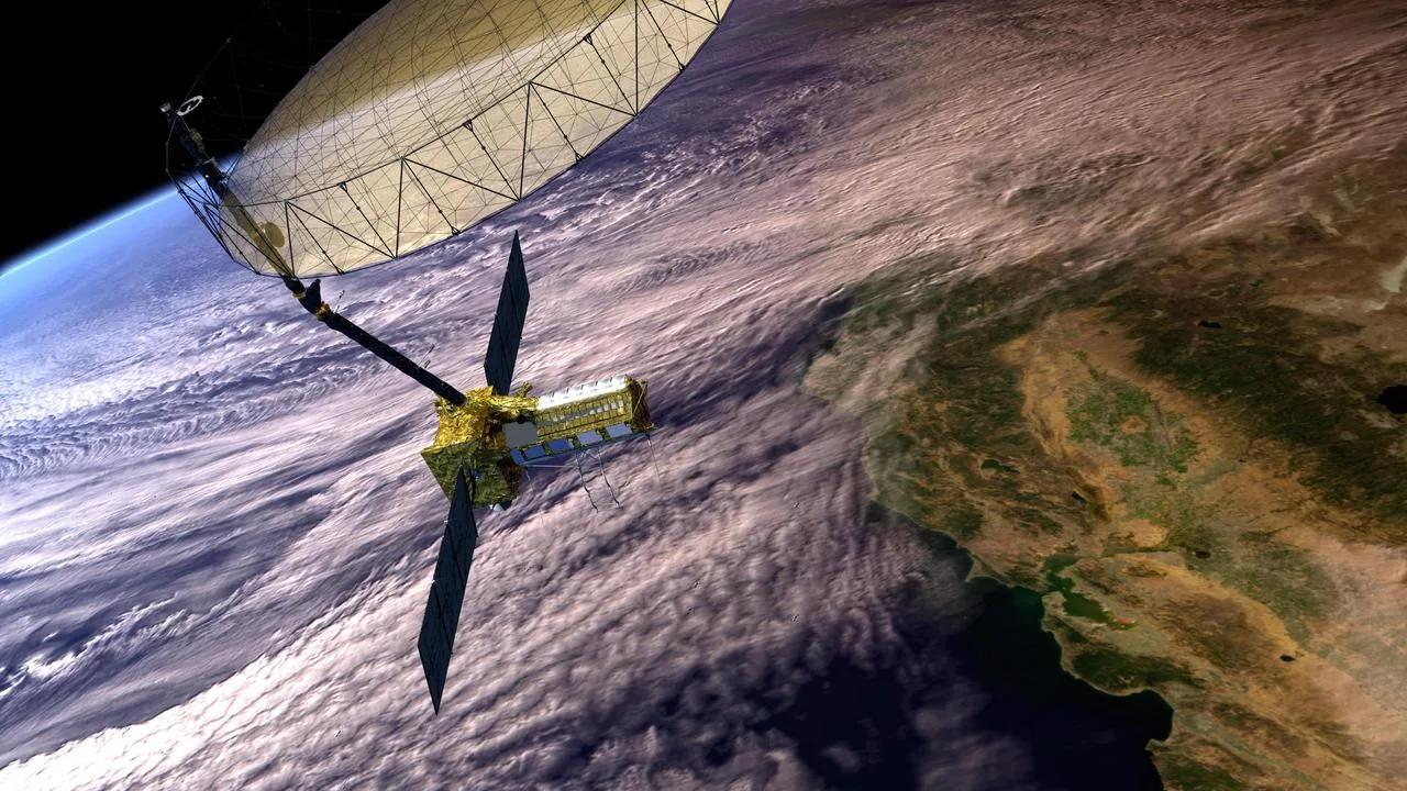
As we look toward the next decade, with new missions like NISAR (a joint NASA-ISRO radar satellite), the expansion of Copernicus with Sentinel upgrades, and the growing fleet of commercial Earth observation satellites, our ability to monitor and understand climate change will only sharpen. The question is no longer whether we can see what is happening to our planet. The question is what we will do about it.