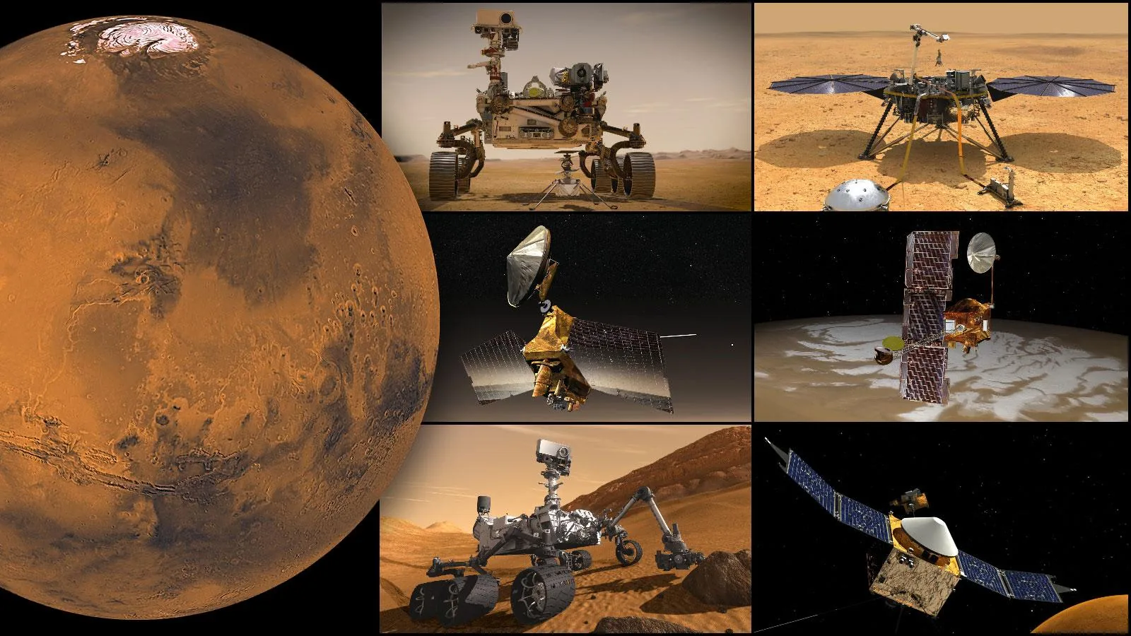
Mars is often described as a cold, dead desert. And yes, the surface is barren, the atmosphere is vanishingly thin, and nothing has erupted or flowed there in what might be millions of years. But to call Mars boring would be to ignore one of the most spectacularly dramatic landscapes in the entire solar system.
Mars is a planet of superlatives. It has the tallest volcano, the deepest canyon, some of the largest impact basins, and polar ice caps that record millions of years of climate history. Its geography tells the story of a world that was once violently active -- a world of fire, water, and catastrophic impacts -- and understanding that geography is essential to understanding what Mars was, what it became, and what it might still have to offer.
Let me take you on a tour. I promise you will never look at that small red dot in the night sky the same way again.
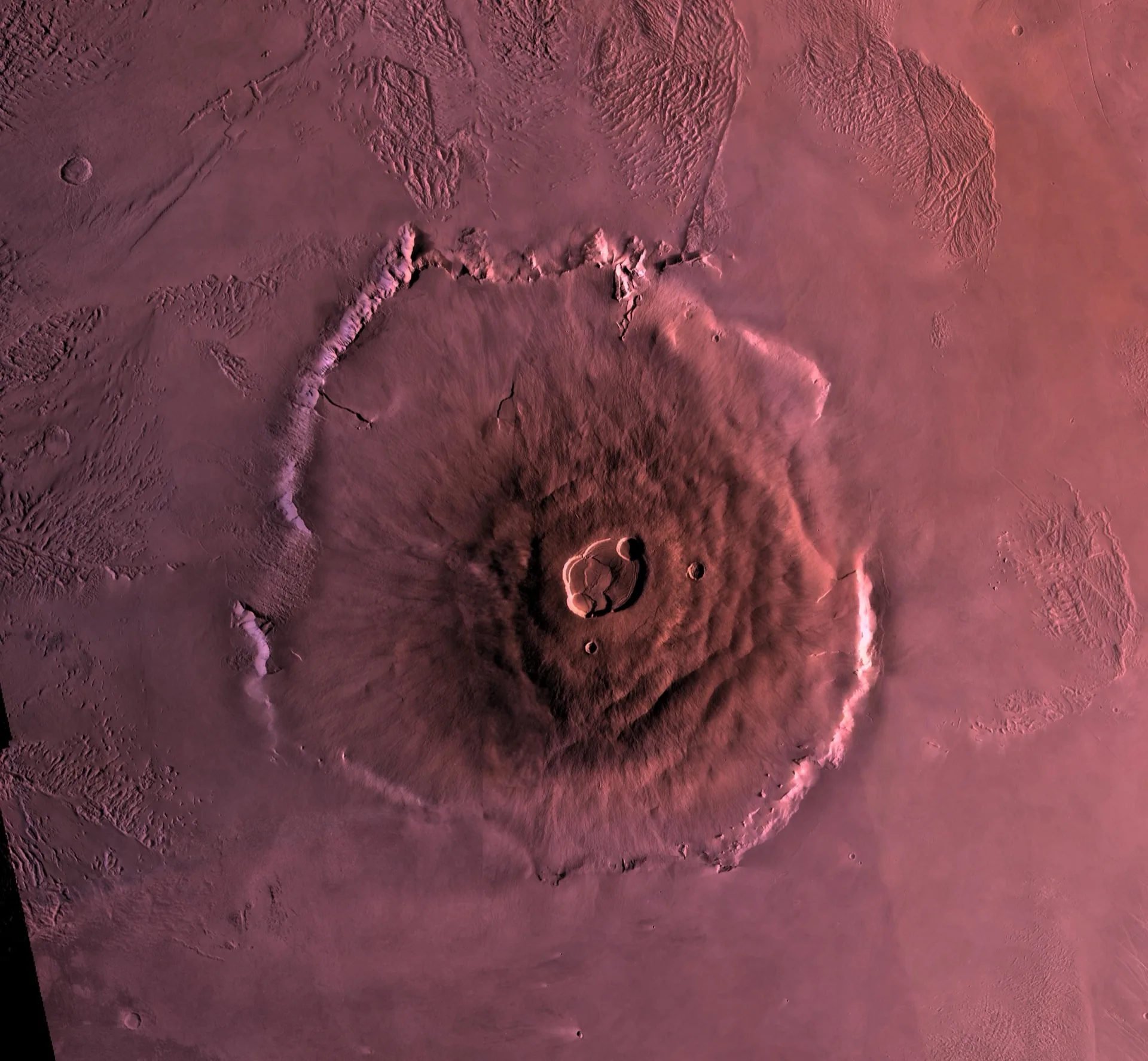
Olympus Mons: The Mountain That Dwarfs Everything

Olympus Mons is, simply put, the largest volcano in the solar system. And the numbers are almost absurd.
It rises approximately 21.9 kilometers above the surrounding plains -- nearly two and a half times the height of Mount Everest above sea level. Its base is roughly 600 kilometers in diameter, about the size of the state of Arizona or the country of Italy. The caldera at its summit -- a complex of nested collapse craters formed by the withdrawal of magma -- is 80 kilometers across and up to 3 kilometers deep. You could fit the entire city of London inside the caldera with room to spare.
Despite its enormous height, Olympus Mons has a remarkably gentle slope, averaging only about 5 degrees. This is because it is a shield volcano, built up over billions of years by countless eruptions of fluid basaltic lava that spread outward in thin sheets before solidifying. On Earth, the Hawaiian Islands are built by the same process -- Mauna Loa is essentially a small-scale Olympus Mons. But Olympus Mons grew so much larger because Mars lacks plate tectonics. On Earth, the Pacific Plate drifts over the Hawaiian hotspot, creating a chain of islands. On Mars, the crust sits still over the mantle plume, and the lava piles up in one place for billions of years.
The most recent lava flows on Olympus Mons have been dated to approximately 25 million years ago based on crater counting -- which sounds ancient, but is geologically recent. Some planetary scientists have speculated that Olympus Mons may not be entirely extinct, though no evidence of current volcanic activity has been detected.
The edges of Olympus Mons are defined by dramatic cliff faces, known as the basal escarpment, that rise up to 8 kilometers -- sheer walls taller than any cliff on Earth. The origin of these cliffs is debated, but they may have formed through a combination of gravitational spreading and erosion by ancient glaciers or landslides.
Standing at the base of Olympus Mons and looking up, you would not see the summit. The mountain is so wide and its slope so gentle that the curvature of Mars would hide the peak long before your eyes could follow the slope to the top. It is a mountain so large it curves with the planet itself.
Valles Marineris: The Grand Canyon's Grand Canyon
If Olympus Mons is the superlative volcano, Valles Marineris is the superlative canyon -- and calling it Mars's version of the Grand Canyon barely scratches the surface.
Valles Marineris stretches approximately 4,000 kilometers across the Martian surface, running roughly east-west just south of the equator. That is approximately the distance from New York to Los Angeles, or from Lisbon to Moscow. It is up to 200 kilometers wide in places and plunges to depths of 7 kilometers -- nearly four times deeper than the Grand Canyon and about ten times longer.
Unlike the Grand Canyon, which was carved primarily by the Colorado River over roughly 5 to 6 million years, Valles Marineris was not carved by water. Its origin is tectonic. The canyon system formed as the Martian crust was stretched and pulled apart by the enormous volcanic uplift of the Tharsis region to the west -- a massive volcanic plateau topped by three huge shield volcanoes (Arsia Mons, Pavonis Mons, and Ascraeus Mons, each comparable in size to the largest volcanoes on Earth). As the Tharsis bulge grew, the crust cracked, and Valles Marineris is the scar.
However, water almost certainly played a role in shaping the canyon over time. The walls of Valles Marineris show evidence of massive landslides, layered sedimentary deposits, and channels that suggest water once flowed through parts of the system. Some sections contain mineral deposits -- including sulfates and clays -- that can only form in the presence of water. The canyon may have held lakes at various points in Martian history, and the outflow channels at its eastern end (Chryse Planitia region) show unmistakable evidence of catastrophic flooding.
Valles Marineris is not a single canyon but a complex system of interconnected troughs, parallel canyons, and chaotic terrain. Its central sections -- Melas Chasma, Candor Chasma, and Ophir Chasma -- contain layered deposits kilometers thick that planetary scientists believe are sedimentary in origin, possibly laid down in ancient lakes or by wind-blown dust. These deposits are prime targets for future exploration because they may contain a record of Mars's climate and potentially biological history.
For future human explorers, Valles Marineris offers something extraordinary: exposed cross-sections of Mars's geological history, with billions of years of rock layers accessible in the canyon walls. It would be the geological fieldwork opportunity of a lifetime -- or several lifetimes.
Hellas Basin: The Deepest Hole on Mars
Hellas Planitia is a massive impact basin in the southern hemisphere of Mars, roughly 2,300 kilometers in diameter and approximately 7.2 kilometers deep from rim to floor. It is the largest visible impact basin on Mars (the even larger Borealis Basin, which may encompass the entire northern lowlands, is still debated) and one of the largest in the solar system.
The impact that created Hellas occurred roughly 4.1 billion years ago, during the Late Heavy Bombardment -- a period when the inner solar system was being pummeled by asteroids and comets. The energy of the impact would have been unimaginable, ejecting material that formed the concentric ring mountains visible around the basin today and potentially melting vast areas of the Martian crust.
What makes Hellas particularly interesting today is its depth. The floor of Hellas Basin is the lowest point on Mars, and at that elevation, the atmospheric pressure is nearly double the Martian average -- about 1,155 pascals compared to the global average of 610 pascals. This higher pressure means that liquid water is slightly more stable on the floor of Hellas than anywhere else on the planet. While still far below the threshold for unprotected human survival, the relatively thicker atmosphere could be an advantage for future aerobraking maneuvers or atmospheric resource extraction.
Hellas is also notorious for its dust storms. The basin acts as a collecting point for atmospheric dust, and some of Mars's most ferocious regional dust storms originate within Hellas before expanding across the planet.
The Tharsis Bulge: A Volcanic Province Like No Other
The Tharsis region is a vast volcanic plateau near the Martian equator, roughly 5,000 kilometers across and elevated about 7 to 10 kilometers above the planetary mean. It represents one of the most significant geological features in the solar system -- a region of volcanic and tectonic activity that shaped much of Mars's surface.
Tharsis is crowned by three enormous shield volcanoes arranged in a line: Arsia Mons (about 18 km high), Pavonis Mons (about 14 km high), and Ascraeus Mons (about 18 km high). Together with nearby Olympus Mons, these four volcanoes represent a concentration of volcanic mass unmatched on any other planet.
The weight of the Tharsis volcanic pile actually deformed Mars's crust, contributing to the opening of Valles Marineris and creating a network of radial fractures that extend thousands of kilometers across the planet. The Tharsis bulge is so massive that it shifted Mars's rotational axis -- the planet literally reoriented itself under the asymmetric mass.
The Polar Regions: Ice Worlds Within a Desert World
Mars's north and south poles are capped by permanent ice deposits that are beautiful, scientifically rich, and strikingly different from each other.
The north polar cap (Planum Boreum) is primarily water ice, roughly 1,000 kilometers in diameter and up to 3 kilometers thick, with a thin seasonal coating of CO2 frost that appears in winter and sublimates in spring. The cap is surrounded by vast dune fields -- the largest erg (sand sea) in the solar system -- composed of dark basaltic sand grains. During northern summer, the retreating CO2 frost reveals intricate spiral troughs carved into the ice cap by a combination of solar heating and wind patterns influenced by the Coriolis effect.
The south polar cap (Planum Australe) is smaller in extent but sits atop a much larger volume of buried ice. Its surface retains a permanent layer of CO2 ice about 8 meters thick year-round -- a feature not seen at the north pole. The south polar region also hosts bizarre terrain known as "Swiss cheese" features -- circular pits in the CO2 ice that grow and merge over successive Martian years, created by sublimation.
Why Mars Geography Matters
These are not just pretty landscapes. Every geological feature on Mars encodes information about the planet's history -- its volcanic activity, its water cycle, its climate evolution, and its potential for harboring life.
Olympus Mons tells us about the longevity and intensity of Martian volcanism. Valles Marineris reveals the tectonic forces that shaped the crust and the water that once flowed through it. Hellas Basin records the violence of the early solar system. The polar caps preserve millions of years of climate data in their layered ice.
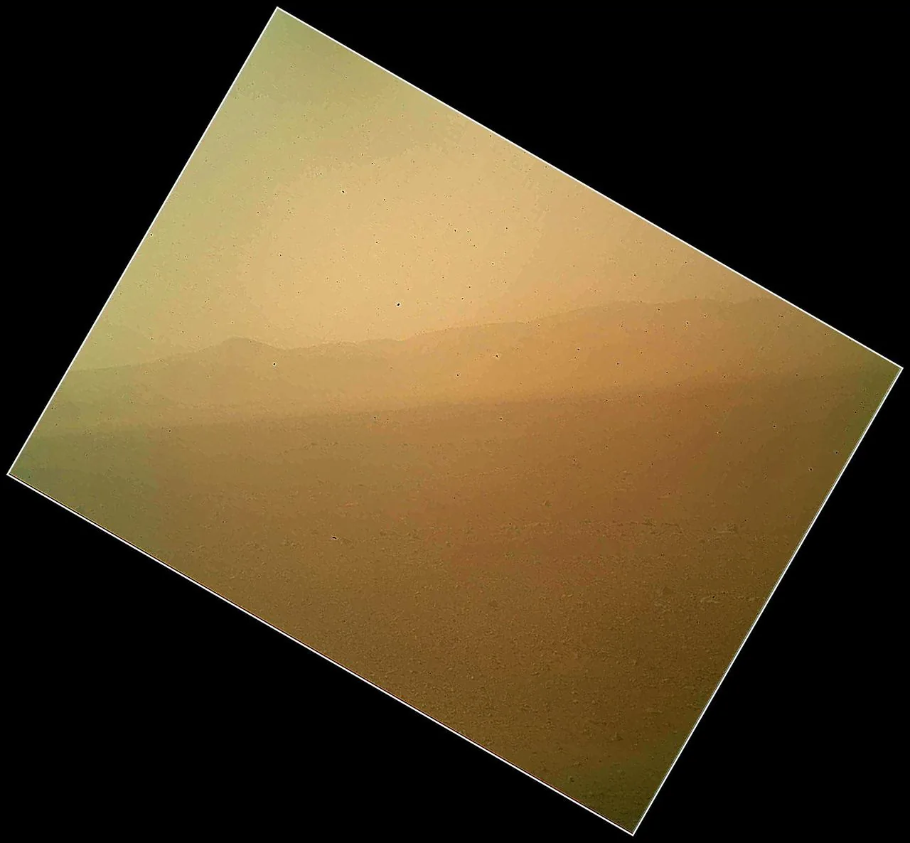
For those of us who love Mars, every image from orbit, every rover panorama, and every topographic map is a window into a world that is at once alien and achingly familiar -- a world with mountains and valleys, ice caps and dust storms, sunrise and sunset. Mars is not just a planet. It is a place. And its geography is an invitation to explore.
I cannot wait for the day when human eyes see these wonders firsthand.