Water IceProspecting — mapped / surveyed
Mid-Latitude Subsurface Ice
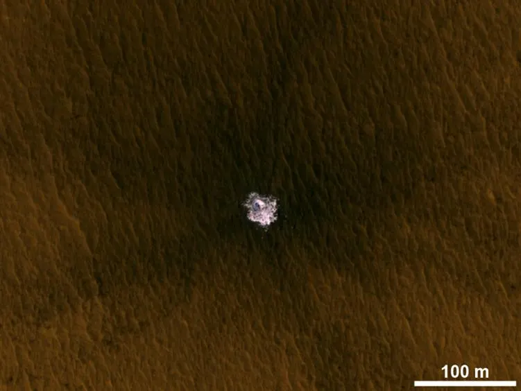
Mid-latitudes (30°–60° N and S), within 1–5 meters of surface
Estimated Quantity
Estimated > 5 million km³ total
Based on GRS/HEND neutron spectroscopy and SHARAD radar stratigraphy
As of 2020-01-01
Location & ISRU Feasibility
Where
Northern mid-latitudes (~30°–60°N); priority crewed-access targets in Arcadia Planitia and Deuteronilus Mensae
Extraction feasibility
High feasibilityNASA's SWIM project maps mid-latitude buried ice as the resource for the first crewed landing sites — far enough poleward for plentiful ice, yet close enough to the equator for survivable temperatures and adequate atmosphere for descent.
Extraction technology
Proposed shallow drilling / heated-auger extraction within the upper ~1 m at favorable sites; mapped by SHARAD radar, neutron spectroscopy and thermal data, but not yet demonstrated on Mars.
Overview
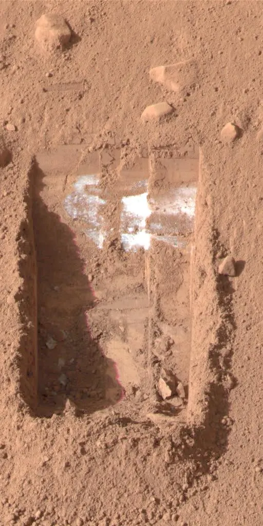
Mars Odyssey's Gamma Ray Spectrometer discovered widespread hydrogen signatures in the top meter of Martian soil at latitudes above 60°, later confirmed as water ice by Phoenix lander (confirmed H2O ice at 5 cm depth in 2008). MRO's SHARAD radar has mapped massive buried glaciers at mid-latitudes — some hundreds of meters thick. These subsurface glaciers are a major ISRU resource target for future crewed missions.
ISRU Application
Primary water source for crewed surface habitats; mining with heated drill could extract several liters/hour per site
Sources
- [1] USGS / Nature Astronomy (Morgan et al. 2021) — retrieved 2026-06-13
- [2] NASA Science — retrieved 2026-06-01
Confidence: high · Last verified 2026-06-01
← All Mars ResourcesContinue your journey
Build it yourself
Build it
Surface Systems Laboratory — build the Mars Habitats
Build it yourself
Continue the story
Mars resource
Volcanic Basaltic Minerals
Continue the story
Continue the story
Mars resource
CO₂ Atmosphere
Continue the story
Continue the story
Mars resource
Potential Geothermal Energy
Continue the story
Continue the story
Mars resource
Iron Oxide Regolith (Martian Soil)
Continue the story
Continue the story
Mars resource
Perchlorate Compounds (ClO4⁻)
Continue the story